With WHIP LIVE you can go anywhere in the country and abroad and always find turn-by-turn directions to your route, road or dirt. Let WHIP LIVE guide you everywhere in total safety.
In 2020 WHIP introduced its unique navigation system that allows you to navigate any road or trail. Many Moto Adventure events, bikepacking and Endurance races use WHIP to navigate and plot routes otherwise not visible on standard maps, such as those in Google Maps.
Offroad navigation
Navigate anywhere with voice and text commands
Offline
Track and navigate even when there is no internet connection
4 Display options
Choose the one that suits you best by scrolling on the screen as you plot or navigate
TURN-BY-TURN DIRECTIONS
Be guided on each path
WHIP's navigation is designed to guide you on every road and trail accurately and reliably, allowing you to receive voice and text directions even where classic navigation devices do not reach
NAVIGATE FROM YOUR DATABASE
Import an external route and navigate it
Import a route in GPX or KML format into the app. You can navigate it directly or you can edit it with the route planner.
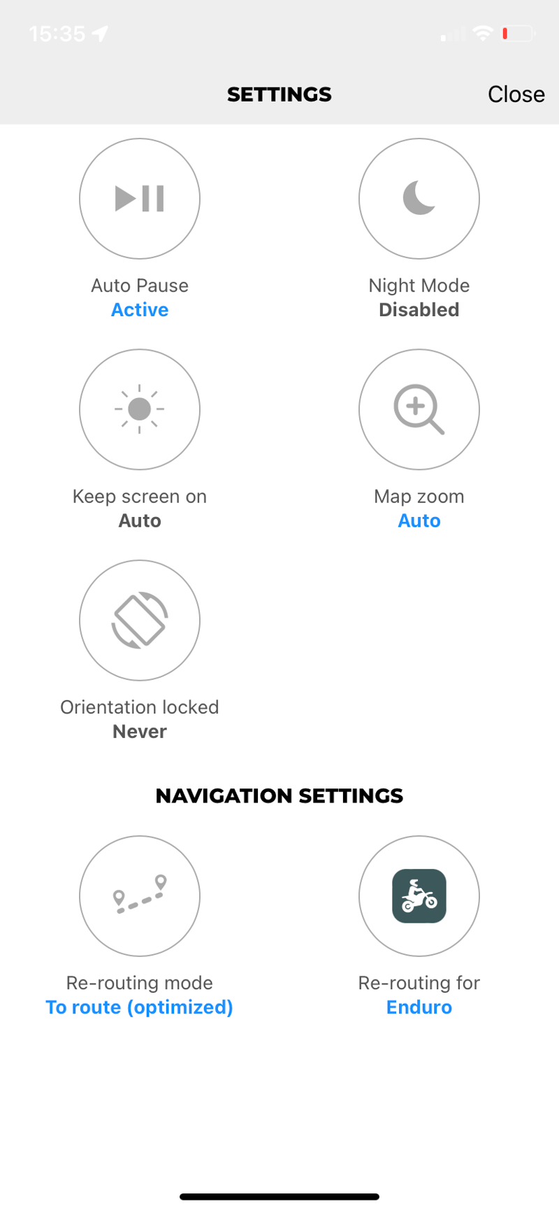
OPTIONS FOR RECALCULATION
Choose the recalculation you prefer
When you end up off course, the automatic recalculation finds the quickest way to re-enter the route. You can change the recalculation option you prefer from the navigation settings
Discover the turn-by-turn navigation
WHIP LIVE overcomes the limitations of traditional navigation apps that only allow you to navigate on roads plotted by regular maps.
Let WHIP LIVE guide you with voice and text directions everywhere, all over the world, on all paths. Choose whether to reach the route from the closest point to you or from the starting point, the navigation will guide you along the best route for you based on your vehicle and the recalculation option selected.
Watch the turn-by-turn navigation tutorial
Follow Our Adventures
Frequently Asked Questions
WHIP LIVE is your digital co-pilot for adventure. It allows you to plan routes optimized for your bike type (Enduro, ADV, Street) or bicycle, navigate turn-by-turn even offline, track your activities with detailed statistics, and share your real-time location for maximum safety.
With the Route Planner, you can create a fully customized route based on your needs. You can choose the type of activity and filter by elevation, gradient, and surface, ensuring you always take the best path for you.
You can add waypoints directly on the map and choose whether to include points of interest, activities, and segments in your route. Points of Interest (POIs) are valuable locations, utilities, and services that you can add to your journey as waypoints.WATCH THE TUTORIAL
With WHIP LIVE you have a tool for safety to rely on to prevent danger or solve an emergency. Before tracking, you can enable LIVE TRACKING to be monitored during your activity by one or more contacts you have selected.
While tracking you can use the Support and Safety button, the shortcut to respond immediately to your needs when you are in trouble. You can send an emergency call, find hospitals, pharmacies and repair stores in the area.
Yes! The free version allows you to track activities, and discover new routes made by other users. The first map to start navigating and planning is completely free.
You can cancel your Plus subscription at any time.
Apple App Store: Your WHIP LIVE subscription is managed through your Apple App Store settings. Use this link to deactivate your subscription: https://support.apple.com/en-us/118428
Google Play Store: Your WHIP LIVE subscription is managed through the Google Play Store settings. Follow the steps at this link to proceed with the cancellation: https://support.google.com/store/answer/11264766?hl=en&sjid=18313732337573027533-EU
Stripe: On the Web, go to gdm.whip.live -> settings -> manage subscription to complete the cancellation.