Discover the maps
of WHIP LIVE

Explore and customize the style of your maps
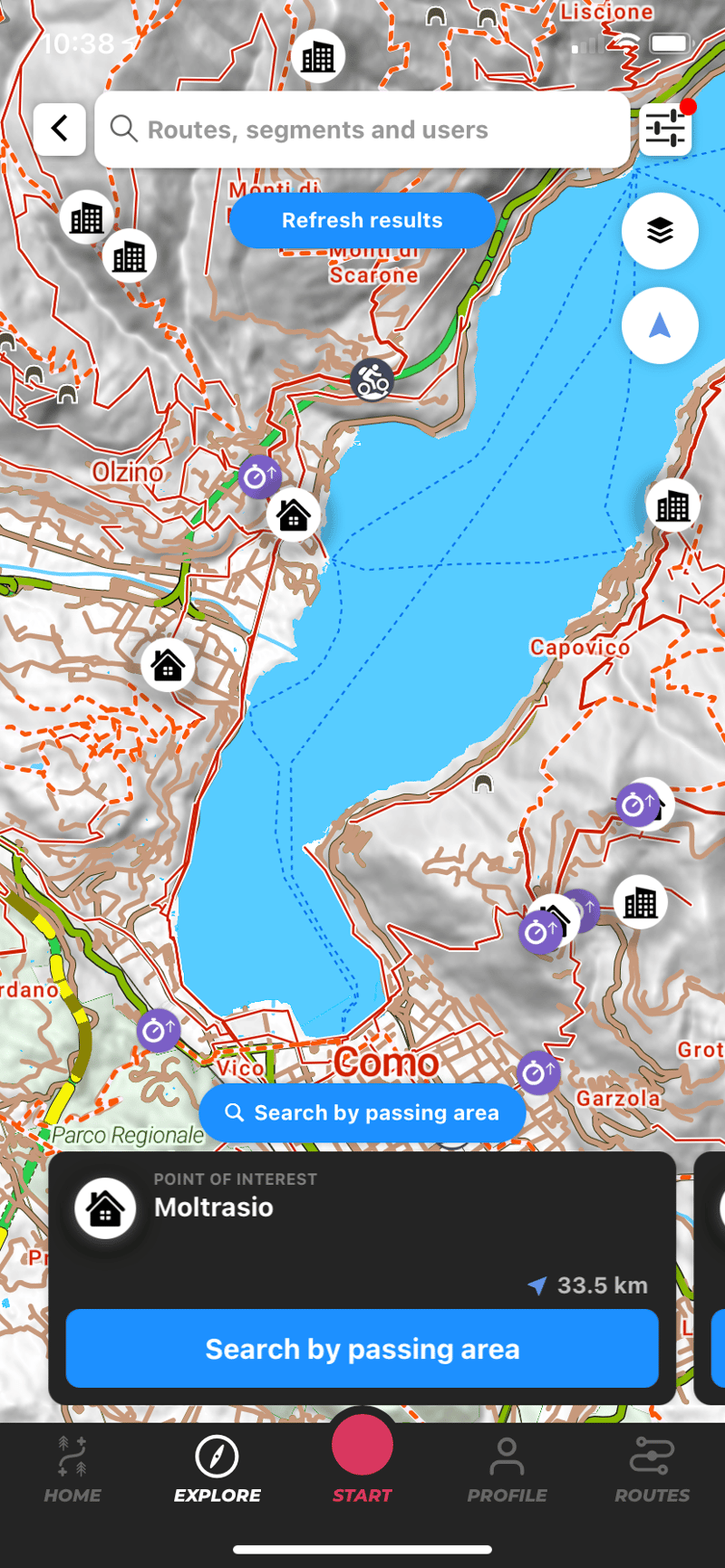
The maps in WHIP LIVE are constantly updated thanks to the Open Street Maps database. In addition to details on millions of trails, including footpaths and dirt roads, WHIP LIVE provides real-time information essential for outdoor activities, such as precipitation levels, wind strength and directions on your route.

Discover the maps

You can choose from as many as 12 types of maps, 3 standard and 9 high-definition, you can choose the most suitable for your activity while the 3D view allows you to see with absolute precision all the roads and paths that interest you.

You can choose between different types of maps, to have the route and terrain view you prefer by varying colors and zoom levels. Changing the map style is possible either while you are tracking or navigating, or after you have saved an activity and want to review it or show it to friends.

Suited for every sport

The maps of WHIP LIVE are designed to adapt to different types of outdoor activities, on foot or on two wheels. You can also select the map based on the vehicle you use for your excursions, finding the mode that best suits your riding or running style. Most popular among our hikers and riders are the MTB, All Trails and CyclOSM maps.

OpenStreetMap Database

More than 700 million routes selected by the OSM community, with automatic, reliable and free updates

All the trails you want

We have integrated all paths from OpenStreetMap and OpenCycleMap

Weather layer

use the real-time wind and precipitation views on each map to check weather conditions
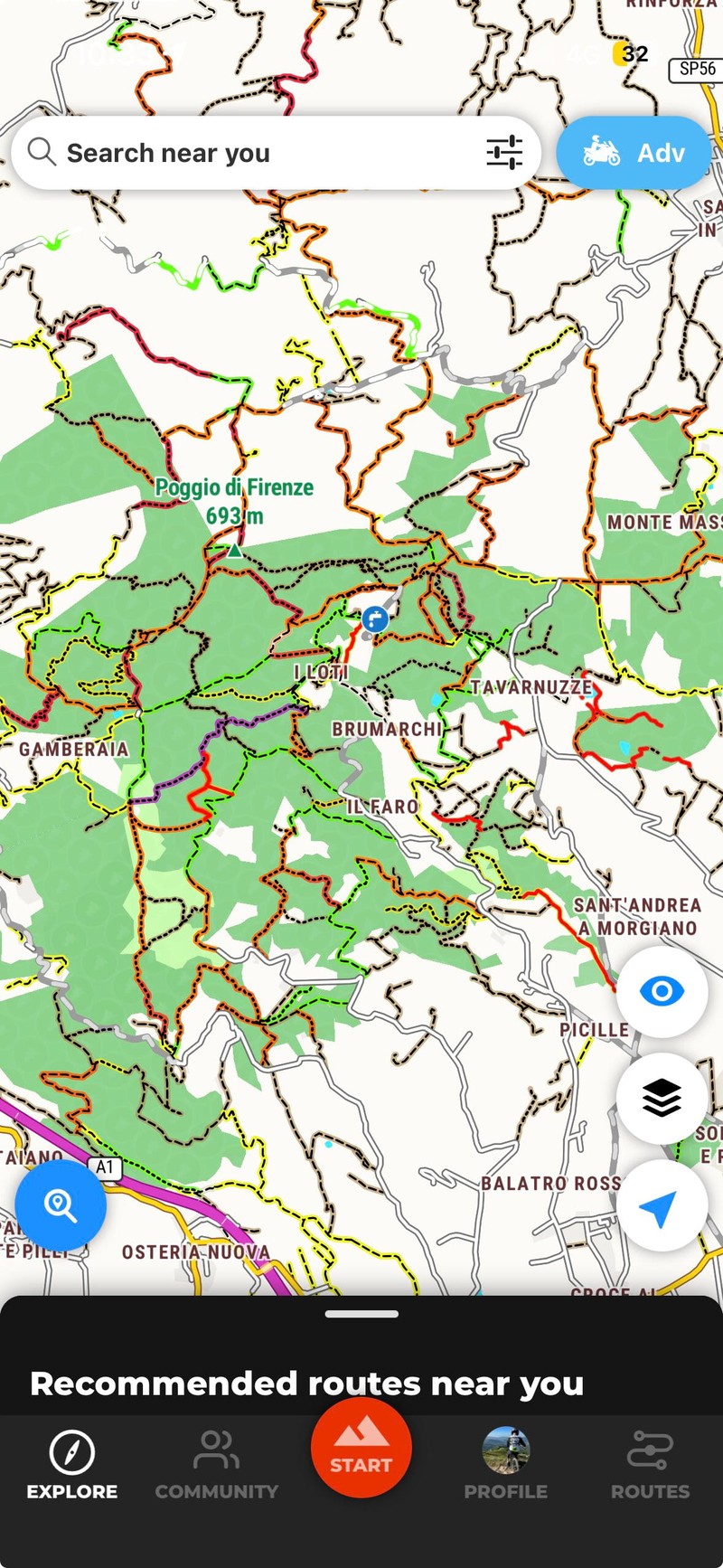
All the trails wherever you are

Take your adventure beyond the road and have fun exploring the trails with this configuration that highlights them all, even the ones you don't expect.

For all occasions

All trails in evidence, perfect for highlighting off-road trails. The two styles, Outdoor and Outdoor Dark, adapt to different light conditions.

Perfect for motorbikes

Designed for motorbike use, the high-visibility map is suitable for orientation and highlighting details of roads and trails in all light conditions while you are moving
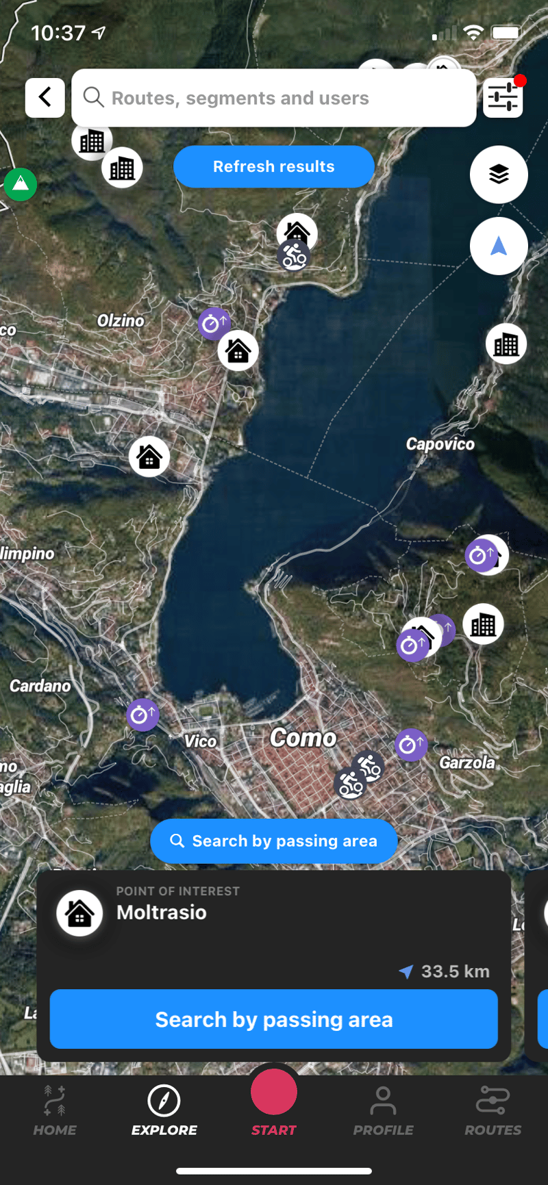
All the details

The satellite view allows you to distinguish details of the landscape while planning a route by navigating roads and paths.
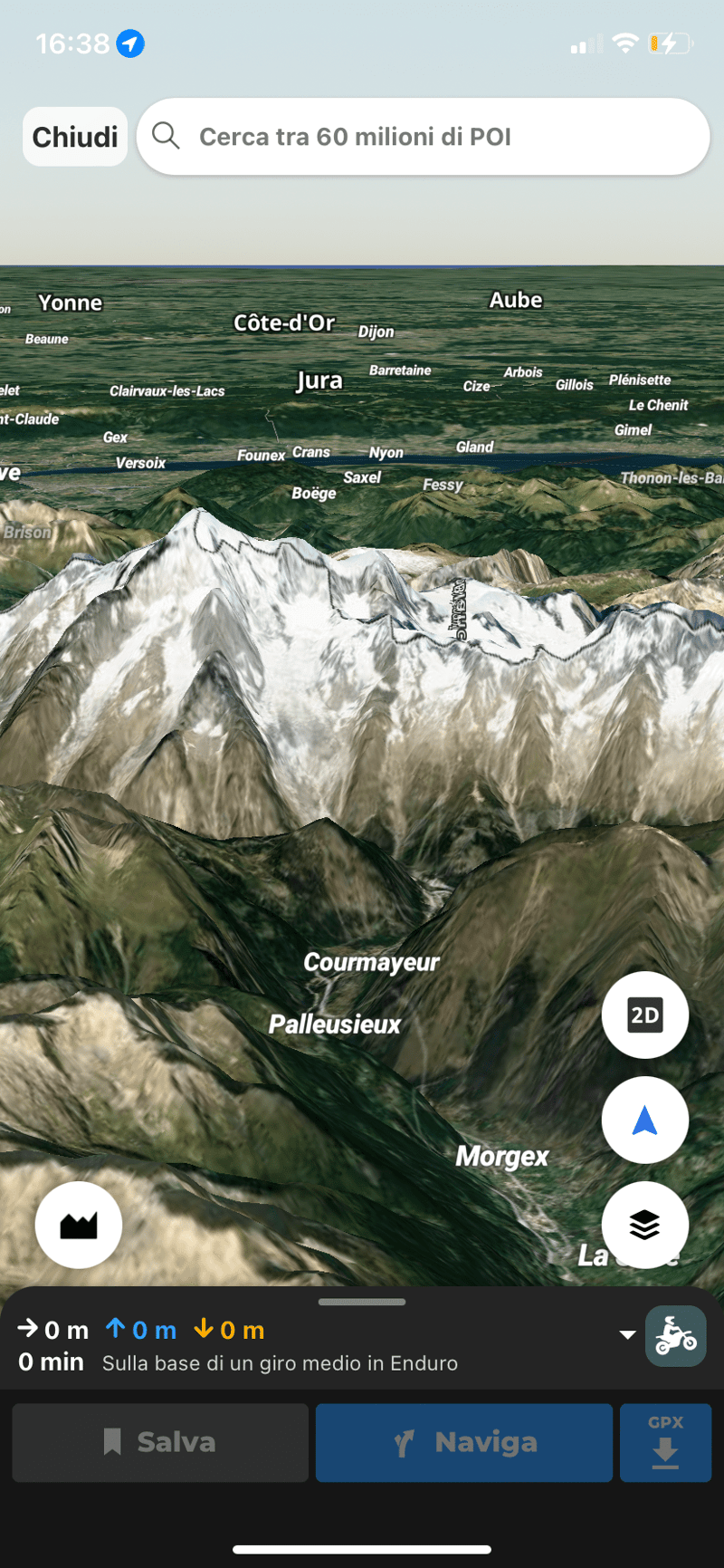
The perfect view

Each map can be viewed in 3D to give you the most accurate view of the routes you want to take

Frequently Asked Questions

Register and set your default activity typology, then add other users. Now you are ready to track your first activity. If you're comfortable instead, you can easily plan your first route. Then you can synchronise your devices and apps for future outings.

If you want to see all routes on the app right away, open the Explore section and find a route around you, you can save it to your routes. In the Routes section you access the Route Planner. You can see all your activities in the Home section and in the Profile section you will find the activities you have tracked, with the general settings at the top right.

Open the Route Planner from Home or from the Routes section. Remember that if you change the type after you have already added waypoints, the previous route will not be adapted. Select your starting point from your current location, either by pressing and holding for more than 3 seconds on the map or by using the indicator.

Add a point of interest, activity or segment to your route. Points of Interest are valuable places, utilities and services that you add to your route as a waypoint. The gear icon next to each waypoint allows you to edit or delete it. The three horizontal lines on the left are used to shift the individual waypoint upwards or downwards, before or after on the route. When you have finished the route press 'Save' or navigate directly to the route.

Yes, you can download WHIP LIVE for free and use all the main functions. 70% of our functions are free, the remaining 30% are part of the paid Plus subscription. The tracking, outdoor basic maps, segment leaderboards, live safety tracking and route planner are free.

With WHIP LIVE you have a tool for safety to rely on to prevent danger or solve an emergency. Before tracking, you can enable LIVE TRACKING to be monitored during your activity by one or more contacts you have selected.

While tracking you can use the Support and Safety button, the shortcut to respond immediately to your needs when you are in trouble. You can send an emergency call, find hospitals, pharmacies and repair stores in the area.