DISCOVER
AND PLAN
NEW ROUTES
EXPERIENCE
THE OUTDOORS
SAFELY
SHARE
YOUR ADVENTURES
WITH FRIENDS
WHERE YOUR
NEXT ADVENTURE
BEGINS

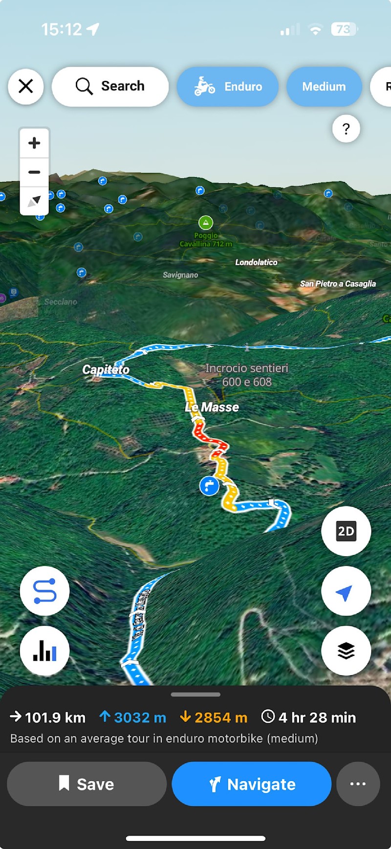
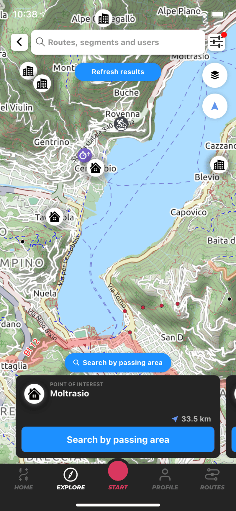
Route Planner
Plan with WHIP LIVE's algorithm to create routes through roads and trails that suit you and your vehicle

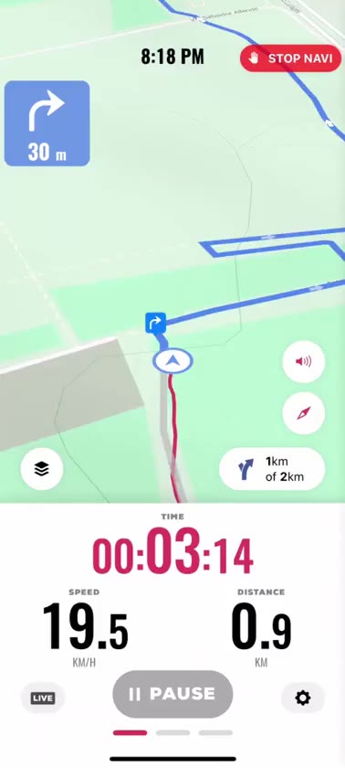
Turn by turn Navigation
Let us guide you through any trail or paved road with WHIP LIVE's prorietary turn-by-turn voice navigation.

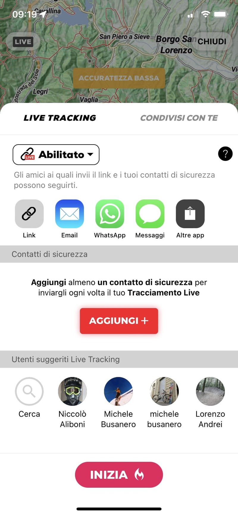
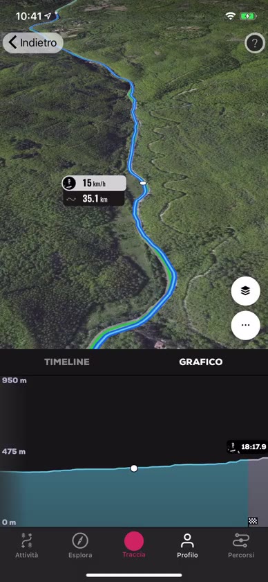
Live Tracking
Keep family and friends updated on your performance by sharing your real-time location.


Experience Off-road Motorcycling to the fullest


Experience Mountain Biking to the fullest


Experience Road Biking to the fullest
Experience Road Motorcycling to the fullest


Experience Trekking & Running to the fullest
The most detailed off-road maps
Explore Locations

Connect with outdoor enthusiast
Next events
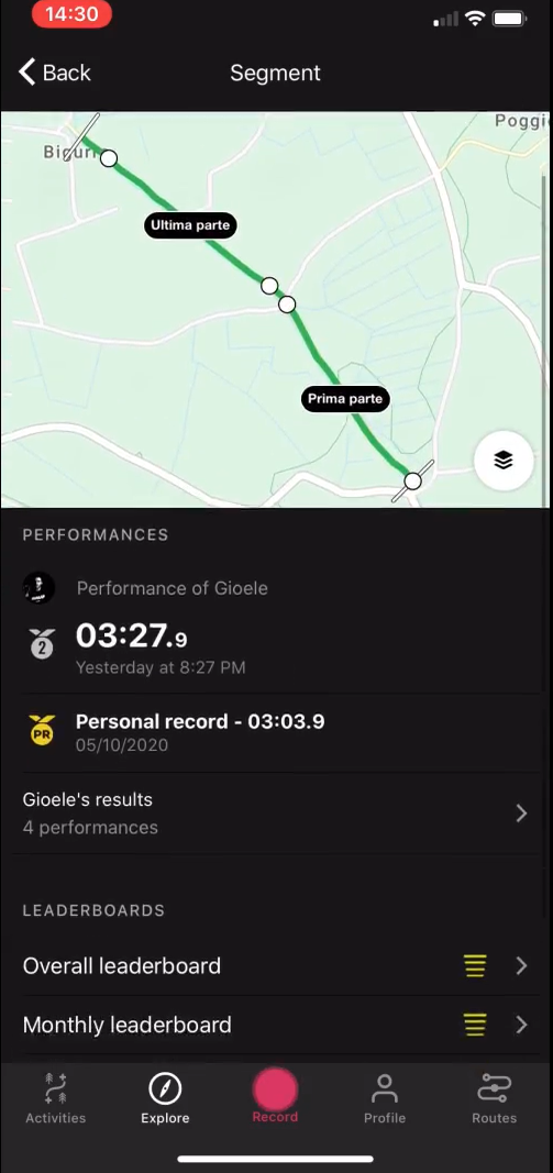
Crafted for bikers and runners
Have your performances, leaderboards and routes based on your bike typology...
What riders say about us

-
I started using WHIP LIVE for the classifcation on segments, but then i found out there was so much more. The route planner is amazing, and the offline maps have been very useful when i was without signal.
-
Actually the only app that properly serves off-road motorcyclist community with specific features of planning and navigation. Since i started using WHIP LIVE, i have no other device on my bike.
-
Been using this app for a few months now and haven't had any problem with it. I've found a lot of routes for gravel bikes as well

Synchronization
Synchronize WHIP LIVE with major apps and tracking devices such as STRAVA and Garmin.

Riders & Runners
Connect with over 50,000 outdoor sports enthusiasts in your area.

Export GPX
Export any route recorded with WHIP LIVE in GPX format.
Follow Our Adventures
ISDE 2025 and GDM
ISDE 2025 & GDM: Behind the scenes at the Six Days Enduro
EVENTS
Live Tracking service for Events
Dakar
Dakar comparison 1983 vs 2022
MOTORBIKE TRAVELS
The islands of the Mediterranean Sea
Best bikepacking routes
Bikepacking trips in Europe
EVENTS
WHIP to KTM Enduro Trophy with important new features
EVENTS
WHIP to Husqvarna Enduro Trophy with important news
EVENTS
WHIP to GASGAS Enduro Trophy with important news
BLOG
Get to know our story
Frequently Asked Questions
WHIP LIVE is your digital co-pilot for adventure. It allows you to plan routes optimized for your bike type (Enduro, ADV, Street) or bicycle, navigate turn-by-turn even offline, track your activities with detailed statistics, and share your real-time location for maximum safety.
With the Route Planner, you can create a fully customized route based on your needs. You can choose the type of activity and filter by elevation, gradient, and surface, ensuring you always take the best path for you.
You can add waypoints directly on the map and choose whether to include points of interest, activities, and segments in your route. Points of Interest (POIs) are valuable locations, utilities, and services that you can add to your journey as waypoints.WATCH THE TUTORIAL
With WHIP LIVE you have a tool for safety to rely on to prevent danger or solve an emergency. Before tracking, you can enable LIVE TRACKING to be monitored during your activity by one or more contacts you have selected.
While tracking you can use the Support and Safety button, the shortcut to respond immediately to your needs when you are in trouble. You can send an emergency call, find hospitals, pharmacies and repair stores in the area.
Yes! The free version allows you to track activities, and discover new routes made by other users. The first map to start navigating and planning is completely free.
You can cancel your Plus subscription at any time.
Apple App Store: Your WHIP LIVE subscription is managed through your Apple App Store settings. Use this link to deactivate your subscription: https://support.apple.com/en-us/118428
Google Play Store: Your WHIP LIVE subscription is managed through the Google Play Store settings. Follow the steps at this link to proceed with the cancellation: https://support.google.com/store/answer/11264766?hl=en&sjid=18313732337573027533-EU
Stripe: On the Web, go to gdm.whip.live -> settings -> manage subscription to complete the cancellation.